|
|
马上注册 与译者交流
您需要 登录 才可以下载或查看,没有账号?立即注册
×
Ruth DeFries
Environmental Geographer | Class of 2007
Combining remote satellite imagery and a deep understanding of the environmental effects of agriculture and urbanization to illuminate key processes transforming our planet.
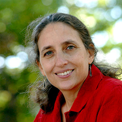
Portrait of Ruth DeFries
Photos for download >
Title
Environmental Geographer
Affiliation
Department of Geography and Earth System Science Interdisciplinary Center, University of Maryland, College Park
Location
College Park, Maryland
Age
50 at time of award
Area of Focus
Geography
Published January 28, 2007
ABOUT RUTH'S WORK
Ruth DeFries is an environmental geographer who uses remotely sensed satellite imagery to explore the relationship between the Earth’s vegetative cover, human modifications of the landscape, and the biochemical processes that regulate the Earth’s habitability. One of the greatest uncertainties researchers face when analyzing the world’s carbon balance is the extent of tropical deforestation. In the past, the deforestation rate has been cobbled together using national statistics on forest cover and coarse-resolution satellite imagery that cannot detect changes finer than the level of individual pixels. Recognizing the limitations of these strategies, DeFries and a team of collaborators developed a more precise approach to mapping land cover that views the landscape as a continuum of land cover characteristics rather than as discrete classes of forests. With this method, DeFries has compiled datasets that have significantly changed the scale and focus of ecosystem research, enhanced her and other researchers’ ability to make more plausible projections of future climate change, and contributed to understanding how human activities are altering habitat needed to conserve biodiversity. At the regional level, she has played a key role in exploring the impact of human-induced changes in land cover, initially focusing on central Africa and moving on to map areas in Southeast Asia and the Brazilian Amazon. Combining expertise with sophisticated satellite-imaging systems and a deep understanding of the environmental effects of agriculture and urbanization, DeFries is providing a clearer picture of the processes transforming our planet.
BIOGRAPHY
Ruth DeFries received a B.A. (1976) from Washington University in St. Louis and a Ph.D. (1980) from Johns Hopkins University. She was a research scientist (1980-1983) at the India Institute of Technology in Bombay and senior project officer (1987-1991) at the National Research Council. She joined the faculty of the University of Maryland, College Park, in 1991, where she is currently a professor with a joint appointment in the Department of Geography and the Earth System Science Interdisciplinary Center.
露丝-德弗里斯
环境地理学家|2007级
结合远程卫星图像和对农业和城市化的环境影响的深刻理解,阐明改变我们星球的关键过程。
露丝-德弗里斯的画像
图片下载 >
标题
环境地理学家
工作单位
马里兰大学地理系和地球系统科学跨学科中心,学院公园
工作地点
马里兰大学帕克分校,马里兰州
年龄
获奖时为50岁
重点领域
地理学
发表于2007年1月28日
关于露丝的工作
露丝-德弗里斯是一名环境地理学家,她利用遥感卫星图像来探索地球植被、人类对景观的改造以及调节地球宜居性的生化过程之间的关系。在分析世界碳平衡时,研究人员面临的最大不确定性之一是热带森林砍伐的程度。在过去,森林砍伐率是利用国家森林覆盖率的统计数据和粗分辨率的卫星图像拼凑而成的,无法检测到比单个像素更精细的变化。认识到这些策略的局限性,DeFries和一个合作者团队开发了一种更精确的方法来绘制土地覆盖图,将景观视为土地覆盖特征的连续体,而不是离散的森林类别。通过这种方法,DeFries汇编的数据集大大改变了生态系统研究的规模和重点,提高了她和其他研究人员对未来气候变化进行更合理预测的能力,并有助于了解人类活动如何改变保护生物多样性所需的生境。在区域层面,她在探索人类引起的土地覆盖变化的影响方面发挥了关键作用,最初专注于非洲中部,然后转向东南亚和巴西亚马逊地区的地图。结合先进的卫星成像系统的专业知识和对农业和城市化的环境影响的深刻理解,德弗里斯正在为改变我们星球的过程提供一个更清晰的图像。
个人简历
露丝-德弗里斯在圣路易斯的华盛顿大学获得学士学位(1976年),在约翰-霍普金斯大学获得博士学位(1980年)。她曾在孟买的印度理工学院担任研究科学家(1980-1983),并在国家研究委员会担任高级项目官员(1987-1991)。她于1991年加入马里兰大学学院帕克分校的教师队伍,目前是地理系和地球系统科学跨学科中心联合任命的教授。 |
|
 |网站地图|手机版|小黑屋|关于我们|ECO中文网
( 京ICP备06039041号 )
|网站地图|手机版|小黑屋|关于我们|ECO中文网
( 京ICP备06039041号 )
 IP卡
IP卡 狗仔卡
狗仔卡 发表于 2022-3-9 04:05:43

 提升卡
提升卡 置顶卡
置顶卡 沉默卡
沉默卡 喧嚣卡
喧嚣卡 变色卡
变色卡 显身卡
显身卡